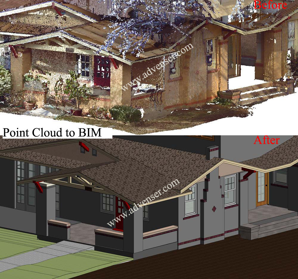
Point cloud is a set of data points in a 3 dimensional coordinate system representing the external surface of an object or building including its geometry and color. 3D scanners are used to measure Point cloud data as a set of vector points, which are then converted to accurate parametric REVIT models. Once imported into Revit, we can trace around the point data with our Revit families quickly building up a 3D model with the point cloud as a reference. The 3D scanned data captures all minute details of the object unlike a manual procedure eliminating the need for repeated visits to the sites
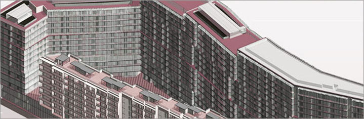
Advenser exports this set of point cloud data onto a CAD or BIM platform such as Revit for architects and engineers and a complete As Built Building Information Model can be created with accuracy depicting the pipes, walls, slabs, roof planes, terrain and vegetation in and around the building. Once the 3D point cloud data is segregated and exported to a BIM package, conventional deliverables like 2D plans, elevations, and sections can be easily extracted. Our architecture team possesses resources with skillset and experience in this procedure. We normally utilize the Revit Families furnished by the client and adapt the specific standards used by them. The image below shows a project which we have recently completed in point cloud conversion.